Granja, Ceará
Granja is the westernmost municipality in the Brazilian state of Ceará.
Granja | |
|---|---|
 Flag  Seal | |
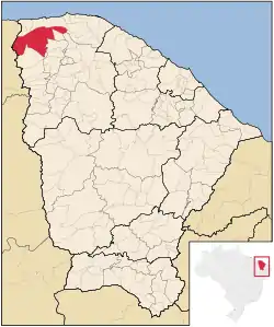 Location of Granja in Ceará | |
| Coordinates: 03°07′12″S 40°49′33″W | |
| Country | Brazil |
| Region | Northeast |
| State | Ceará |
| Founded | 1776 |
| Government | |
| • Mayor | Francisco Geovane da Rocha Brito |
| Area | |
| • Total | 2,697.202 km2 (1,041.396 sq mi) |
| Elevation | 10 m (30 ft) |
| Population (2020 [1]) | |
| • Total | 54,962 |
| • Density | 19.9/km2 (52/sq mi) |
| Time zone | UTC−3 (BRT) |
| HDI (2000) | 0.554 – medium[2] |
The municipality contains part of the 1,592,550 hectares (3,935,300 acres) Serra da Ibiapaba Environmental Protection Area, created in 1996.[3]
References
- IBGE 2020
- Archived 2009-10-03 at the Wayback Machine UNDP
- APA Serra da Ibiapaba (in Portuguese), ISA: Instituto Socioambiental, retrieved 2017-02-10
This article is issued from Wikipedia. The text is licensed under Creative Commons - Attribution - Sharealike. Additional terms may apply for the media files.