Glavinitsa Peak
Glavinitsa Peak (Bulgarian: връх Главиница, romanized: vrah Glavinitsa, IPA: [ˈvrɤɣ ɡɫɐˈvinit͡sɐ]) is the peak rising to 1504 m[1] in the central part of Rudozem Heights on German Peninsula, Fallières Coast in Graham Land, Antarctica. It has precipitous and partly ice-free northwest and south slopes, and is surmounting Bader Glacier to the north and Bucher Glacier to the southwest.
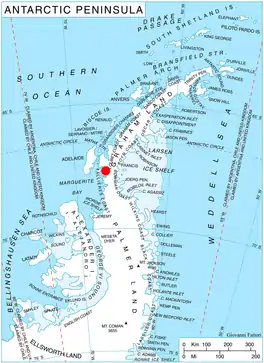
Location of German Peninsula in Graham Land, Antarctic Peninsula.
The peak is named after the town of Glavinitsa in Northeastern Bulgaria.
Location
Glavinitsa Peak is located at 67°38′34″S 66°42′36″W, which is 12.84 km northeast of Bottrill Head and 6.71 km south-southeast of Thomson Head. British mapping in 1978.
Maps
- British Antarctic Territory. Scale 1:200000 topographic map. DOS 610 Series, Sheet W 67 66. Directorate of Overseas Surveys, Tolworth, UK, 1978.
- Antarctic Digital Database (ADD). Scale 1:250000 topographic map of Antarctica. Scientific Committee on Antarctic Research (SCAR), 1993–2016.
Notes
- Reference Elevation Model of Antarctica. Polar Geospatial Center. University of Minnesota, 2019
References
- Glavinitsa Peak. SCAR Composite Antarctic Gazetteer
- Bulgarian Antarctic Gazetteer. Antarctic Place-names Commission. (details in Bulgarian, basic data in English)
External links
- Glavinitsa Peak. Copernix satellite image
This article includes information from the Antarctic Place-names Commission of Bulgaria which is used with permission.
This article is issued from Wikipedia. The text is licensed under Creative Commons - Attribution - Sharealike. Additional terms may apply for the media files.