Ghamubar Zom
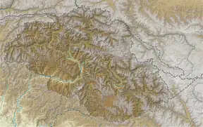
Ghamubar Zom (Urdu: گموبر دزوم) is a mountain in the Hindu Raj mountain range of Asia. Located in Gilgit–Baltistan, Pakistan, it has a summit elevation of 6,518 m above sea level.[2] The mountain is close to the border of Gilgit–Baltistan and Khyber Pakhtunkhwa. The nearest village from the mountain is Darkot in Yasin valley.
| Ghamubar Zom گموبر دزوم | |
|---|---|
 Ghamubar Zom from Drakot Pass | |
| Highest point | |
| Elevation | 6,518 m (21,385 ft)[1] |
| Prominence | 2,133 m (6,998 ft)[1] |
| Listing | Ultra |
| Coordinates | 36°35′24″N 73°20′30″E[1] |
| Geography | |
 Ghamubar Zom گموبر دزوم Location in Pakistan | |
| Location | Gilgit–Baltistan, Pakistan |
| Parent range | Hindu Raj |
The entire prominence of mountain is visible from Darkot and Rawat villages.
References
- "The Karakoram, Pakistan Himalaya and India Himalaya (north of Nepal)". Peaklist.org. Retrieved 2015-02-16.
- "Ghamubar Zom, Pakistan". Peakbagger.com. Retrieved 2015-02-16.
This article is issued from Wikipedia. The text is licensed under Creative Commons - Attribution - Sharealike. Additional terms may apply for the media files.