Fort Lincoln (Washington, D.C.)
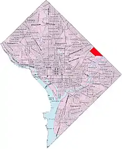
Fort Lincoln is a neighborhood located in northeastern Washington, D.C. It is bounded by Bladensburg Road to the northwest, Eastern Avenue to the northeast, New York Avenue NE to the south, and South Dakota Avenue NE to the southwest. The town of Colmar Manor, Maryland, is across Eastern Avenue from the Fort Lincoln neighborhood, as is the Fort Lincoln Cemetery.
Fort Lincoln | |
|---|---|
 Fort Lincoln within the District of Columbia | |
| Country | United States |
| District | Washington, D.C. |
| Ward | Ward 5 |
| Government | |
| • Councilmember | Kenyan McDuffie |
| Area | |
| • Total | 0.47 sq mi (1.2 km2) |
The name Fort Lincoln was originally used for a Civil War Fort in adjacent Prince George's County, Maryland, across the D.C. line from the Washington neighborhood bearing its name.
Neighborhood

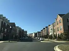
This northeast Washington neighborhood is home to the Fort Lincoln "New Town" development constructed in the 1960s and 1970s.[1] This neighborhood is currently the home of Cathy Lanier, former Chief of the D.C. Metropolitan Police.[2]
In 2011 another 42 acres of the wetland forest park was sold to make a shopping center.[3][4] The shopping center includes a Costco store that opened in November 2012.[5]
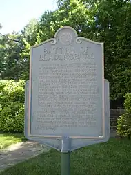
War of 1812 battlefield site

References
- Ellen Hoffman (September 26, 1969). "New Towners The Voiceless Marylanders, Columbia Citizens Seeking More Say". The Washington Post.
- "Hope Stirs In Fort Lincoln Growth, New Neighbor Inspire Pocket of D.C. to Believe in Change," By Clarence Williams, The Washington Post, April 30, 2007, p. B01.
- Kelly (December 13, 2011). "Shops at Dakota Crossing and Costco to Start Now, Open Next Year". DCmud. DCRE, INC. Retrieved December 14, 2011.
- "Fort Lincoln Wetlands". Anacostia Riverkeeper. Waterkeeper Alliance. 2010. Retrieved December 27, 2011.
- Fazeli Fard, Maggie (November 29, 2012). "D.C. welcomes its first Costco". The Washington Post. Retrieved August 30, 2023.