Ezerets Knoll
Ezerets Knoll (Bulgarian: Езерецка могила, ‘Ezeretska Mogila’ \e-ze-'rets-ka mo-'gi-la\) is the narrow, mostly ice-covered ridge extending 3.35 km in west-northwest to east-southeast direction, 800 m wide and rising to 1294 m[1] in the west foothills of Bruce Plateau on Graham Coast in Graham Land, Antarctica. It surmounts Hugi Glacier to the west and its tributary Rickmers Glacier to the northeast.
The knoll is named after the settlements of Ezerets in Northeastern and Southwestern Bulgaria.
Location
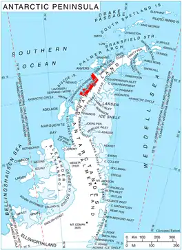
Ezerets Knoll is located at 66°14′17″S 64°57′36″W, which is 16.2 km west-northwest of Richardson Nunatak, 18 km east of Crookes Peak, 6 km southwest of Dodunekov Bluff and 2.6 km southwest of Nauchene Nunatak. British mapping in 1976.
Maps
- Antarctic Digital Database (ADD). Scale 1:250000 topographic map of Antarctica. Scientific Committee on Antarctic Research (SCAR). Since 1993, regularly upgraded and updated.
- Antarctic Digital Database (ADD). Scale 1:250000 topographic map of Antarctica. Scientific Committee on Antarctic Research (SCAR). Since 1993, regularly upgraded and updated.
Notes
- Reference Elevation Model of Antarctica. Polar Geospatial Center. University of Minnesota, 2019
References
- Bulgarian Antarctic Gazetteer. Antarctic Place-names Commission. (details in Bulgarian, basic data in English)
- Ezerets Knoll. SCAR Composite Antarctic Gazetteer.
External links
- Ezerets Knoll. Copernix satellite image
This article includes information from the Antarctic Place-names Commission of Bulgaria which is used with permission.