Erul Heights
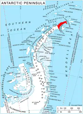
Erul Heights (Bulgarian: Ерулски възвишения, ‘Erulski Vazvisheniya’ \e-'rul-ski v&z-vi-'she-ni-ya\) are the heights rising to 1083 m (Gigen Peak) on Trinity Peninsula in Graham Land, Antarctica. They are bounded by Russell East Glacier to the south and Cugnot Ice Piedmont to the north, extending 8 km from Benz Pass in east-southeast direction towards Smokinya Cove, and surmounting Prince Gustav Channel, Weddell Sea to the southeast.
The heights are named after the settlement of Erul in Western Bulgaria.
Location
Erul Heights are centred at 63°42′10″S 58°21′10″W. German-British mapping in 1996.
Maps
- Trinity Peninsula. Scale 1:250000 topographic map No. 5697. Institut für Angewandte Geodäsie and British Antarctic Survey, 1996.
- Antarctic Digital Database (ADD). Scale 1:250000 topographic map of Antarctica. Scientific Committee on Antarctic Research (SCAR). Since 1993, regularly updated.
References
- Erul Heights. SCAR Composite Antarctic Gazetteer
- Bulgarian Antarctic Gazetteer. Antarctic Place-names Commission. (details in Bulgarian, basic data in English)
External links
Erul Heights. Copernix satellite image
This article includes information from the Antarctic Place-names Commission of Bulgaria which is used with permission.