Eremiya Hill
Eremiya Hill (Bulgarian: Еремийски хълм, ‘Eremiyski Halm’ \e-re-'miy-ski 'h&lm\) is an ice-covered hill rising to 863m in the west part of Marescot Ridge on Trinity Peninsula in Graham Land, Antarctica. It is surmounting Malorad Glacier to the southwest.
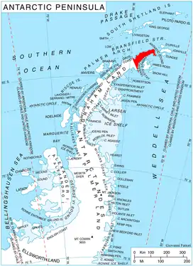
Location of Trinity Peninsula.
The hill is named after the settlement of Eremiya in Western Bulgaria.
Location
Eremiya Hill is located at 63°32′45″S 58°37′46″W, which is 3.48 km west-northwest of Crown Peak, 4.83 km north-northeast of Corner Peak, 6 km southeast of Thanaron Point and 5.89 km southwest of Bardarevo Hill. German-British mapping in 1996.
Maps
- Trinity Peninsula. Scale 1:250000 topographic map No. 5697. Institut für Angewandte Geodäsie and British Antarctic Survey, 1996.
- Antarctic Digital Database (ADD). Scale 1:250000 topographic map of Antarctica. Scientific Committee on Antarctic Research (SCAR). Since 1993, regularly updated.
References
- Eremiya Hill. SCAR Composite Antarctic Gazetteer
- Bulgarian Antarctic Gazetteer. Antarctic Place-names Commission. (details in Bulgarian, basic data in English)
External links
- Eremiya Hill. Copernix satellite image
This article includes information from the Antarctic Place-names Commission of Bulgaria which is used with permission.
This article is issued from Wikipedia. The text is licensed under Creative Commons - Attribution - Sharealike. Additional terms may apply for the media files.