Englisberg
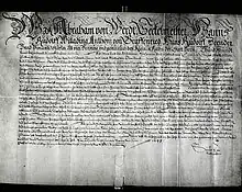
Englisberg is a village in the district of Seftigen in Canton Bern, Switzerland. On January 1, 2004, the independent municipality merged with Zimmerwald to form the new municipality of Wald BE. Situated on the Längenberg, above the valley of the Aare river, it combines the villages of Englisberg and Kühlewil. Englisberg is first documented in 1166 [Endlisperc]. It is believed that Englisberg was created out of the much older village of Kühlewil [Cullenwil, Cullenwilare - originally of Celtic origin] the latter of which having since attained the status of a hamlet of the former. In the 14th century a castle is documented in Englisberg, owned by the family of the same name. It was abandoned by the following 15th century and quickly fell into disrepair and disintegration. The feudal rights over Englisberg were acquired by the von Erlach family of Bern in 1433 and passed in 1542 to the Baumgartner family of the same place. After 1570, these feudal rights were sold to local farming families Guggisberg and Zimmermann which over the course of several generations were split into 70 shares. In the 18th century, these rights were successively purchased by the aristocratic von Graffenried and von Tscharner families seated at the Lohn estate in Kehrsatz only to lose it all when Switzerland was invaded by the French in 1798 that resulted in the abolishment of the ancient order. Englisberg belonged until 1798 to the high court district of Seftigen. Ecclesiastically Englisberg was part of the evangelical reformed parish church of neighboring Belp till 1699 and thereafter was integrated into the newly created parish of Zimmerwald.[1][2][3][4][5][6][7][8][9][10][11][12][13][14]
%252C_Armenanstalt_K%C3%BChlewil-Inlandfl%C3%BCge-LBS_MH03-0231.tif.jpg.webp)



Census Data: 1764: 223 inhabitants;1850: 275 inhabitants; 1900: 567 inhabitants;1950: 564 inhabitants; 2000: 214 inhabitants
Predominant surnames with long-established ancestry preceding 1798: - Balsiger, since the 16th century / - Guggisberg, since the 15th century / - Hosmann and Hossmann since the 17th century / - Streit, since the 16th century / - Zimmermann, since the 16th century
Englisberg is the birthplace of former Swiss ice hockey player Mark Streit.
Prominent Englisberg citizens and residents
- Rudolf Joder (1950), Swiss politician, National Council
- Mark Streit (1977), hockey player
References
- Staatsarchiv Bern: Urkundensammlung, Udelbuch of 1389, Contractmanuale of Seftigen District 16th - 18th century
- Gemeindearchiv Englisberg, Wald BE: Urkundensammlung, Gemeinderatsprotokolle
- Leu, Johann Jacob: Allgemeines Helvetisches, Eydgenössisches, Oder Schweitzerisches Lexicon, Zürich 1746-1765
- Köniz, Ludwig F.: Historische, geographische und physikalische Beschreybung des Schweizerlandes, volume II, Bern 1783
- Gruner, Gottlieb: Versuch einer physisch-statistisch-ökonomischen Beschreibung der Gemeinde Wiegewohnt, manuscript by pastor Gottlieb Gruner, 1823, Stadt- und Universitätsbibliothek Bern
- Jahn, Albert: Der Kanton Bern, Bern 1853
- Fontes Rerum Bernensium, Berns Geschichtsquellen, volumes 1 through 10, published by Stämpfliverlag Bern, 1883-1956
- Knapp, Charles; Borel, Maurice; Attinger, Victor and Brunner, Heinrich: Geographisches Lexikon der Schweiz, volume 2, Société neuchâteloise de géographie, Neuchâtel 1904
- Anonymous: Heimatkunde des Amtes Seftigen, Bern 1906
- Anonymous: Historisch-Biographisches Lexikon der Schweiz, volume 3, Neuchâtel 1927
- Weilenmann, Heinz: Die Herrschaft Englisberg, in "Berner Zeitschrift für Geschichte und Heimatkunde", Bern 1961
- Brönnimann, Fritz: Beiträge zur Geschichte und Heimatkunde des Längenberges, Wie entstand unsere Gemeinde, parts 1 and 2, published by the village of Zimmerwald, 1988
- Guggisberg, Daniel: Feuerstättenzählung 1558 in der Kirchgemeinde Belp, Mitteilungen der Genealogisch-Heraldischen Gesellschaft Bern. - Bern. - volume 19 (31 May 2000), pages 14–27
- Guggisberg, D. A.: Architektonische Gebäudeinschriften-Bestandsaufnahme von Englisberg, 2002, manuscript, Staatsarchiv Bern
External links
- Englisberg in German, French and Italian in the online Historical Dictionary of Switzerland.
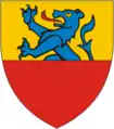 coat of arms of Englisberg
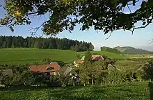
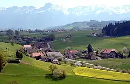 village of Englisberg
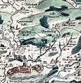
 16th century map by Doctor Thomas Schöpf dated 1580