Elder Place, Fremantle
Elder Place in a street in Fremantle, Western Australia that primarily runs between the north-west ends of Parry Street and Queen Street, south-west of the Fremantle railway line. At the north-eastern end Elder Place becomes Beach Street; at the south-western end it becomes Phillimore Street. A small cul de sac, also called Elder Place, but not connected to the main street, runs off Phillimore Street, in the direction of Market Street.
Elder Place | |||
|---|---|---|---|
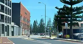 | |||
| Looking south on Elder Place from Parry Street intersection | |||
| General information | |||
| Type | Street | ||
| Length | 450 m (0.3 mi)[1][2] | ||
| Major junctions | |||
| |||
| Northeast end | |||
| Goldsbrough Street | |||
| Southwest end | |||
| |||
| North end | Phillimore Street | ||
| South end | Cul-de-sac north of Market Street | ||
| Location(s) | |||
| Suburb(s) | Fremantle | ||

Parry Street and Elder Place intersection
The southern side of the street was taken up with a large building known as Elders Wool Store,[3] which was run by Elder, Smith and Company.[4][5] This building was demolished and replaced by the Woolstores Shopping Centre.
In the late nineteenth century, the street was known as Bay Street.[6]
Intersections
Elder Place (main)
| LGA | Location[1] | km | mi | Destinations | Notes |
|---|---|---|---|---|---|
| Fremantle | Fremantle | 0 | 0.0 | Beach Street / Parry Street | Elder Place continues northeast as Beach Street |
| 0.19 | 0.12 | Goldsbrough Street | Stop sign controlled, giving Elder Place priority | ||
| 0.35 | 0.22 | Fremantle station bus exit | Traffic light controlled | ||
| 0.4 | 0.25 | Phillimore Street / Queen Street | Uncontrolled seagull intersection; Elder Place continues southwest as Phillimore Street | ||
| 1.000 mi = 1.609 km; 1.000 km = 0.621 mi | |||||
Elder Place (cul-de-sac)
| LGA | Location[2] | km | mi | Destinations | Notes |
|---|---|---|---|---|---|
| Fremantle | Fremantle | 0 | 0.0 | Phillimore Street | Left-in/left-out |
| 0.05 | 0.031 | Cul-de-sac | Elder Place terminus; adjacent to Market Street | ||
| 1.000 mi = 1.609 km; 1.000 km = 0.621 mi | |||||
Notes
- "Elder Place". Google Maps. Retrieved 30 November 2022.
- "Elder Place". Google Maps. Retrieved 30 November 2022.
- "ELDERS WOOL STORE and PORT OF FREMANTLE". Western Mail. Western Australia. 13 April 1950. p. 51. Retrieved 15 January 2017 – via National Library of Australia.
- "FREMANTLE". The West Australian. Vol. 53, no. 16, 040. Western Australia. 24 November 1937. p. 14. Retrieved 15 January 2017 – via National Library of Australia.
- "ELDER'S WOOL STORE, ELDER PLACE, FREMANTLE". Western Mail. Vol. XLVIII, no. 2, 445. Western Australia. 22 December 1932. p. 20 (THE WESTERN MAIL XMAS). Retrieved 15 January 2017 – via National Library of Australia.
- Item 0637 - Fremantle Sheet 3 [Tally No. 504252]., 6 August 1898
External links
 Media related to Elder Place, Fremantle at Wikimedia Commons
Wikimedia Commons has media related to Elder Place, Fremantle.
Streets of Fremantle, Western Australia, Australia | ||||||
|---|---|---|---|---|---|---|
| Fremantle city centre |
| |||||
| Greater Fremantle | ||||||
| ||||||
This article is issued from Wikipedia. The text is licensed under Creative Commons - Attribution - Sharealike. Additional terms may apply for the media files.