Das Antas River (Rio Grande do Sul)
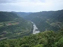
The Das Antas River is a river of Rio Grande do Sul state in southern Brazil. Below its junction with the Carreiro it forms the Taquari River.[1]
| Das Antas River | |
|---|---|
 | |
| Location | |
| Country | Brazil |
| Physical characteristics | |
| Source | |
| • location | Aparados da Serra National Park |
| • elevation | 1,200 m (3,900 ft) |
| Mouth | Taquari River |
• coordinates | 29°5′S 51°43′W |
• elevation | 100 m (330 ft) |
| Length | 390 km (240 mi) |
See also
References
- Vocabulário geográfico do estado do Rio Grande do Sul (in Portuguese). 1950. p. 250.
Antas—Rio (das), ... Alfredo Chaves e Guaporé, separados pelo Carreiro, afluente da margem direita, abaixo de cuja Barra o rio das Antas toma o nome de Taquari
This article is issued from Wikipedia. The text is licensed under Creative Commons - Attribution - Sharealike. Additional terms may apply for the media files.