D508 road
D508 is a state road in Hrvatsko Zagorje region of Croatia connecting Macelj border crossing to Slovenia[1] and the A2 motorway Trakošćan interchange to the city of Lepoglava and to Trakošćan.[2] The road is 19.2 km (11.9 mi) long.[3]
 | |
|---|---|
| Route information | |
| Length | 19.2 km (11.9 mi) |
| Major junctions | |
| From | |
| To | |
| Location | |
| Country | Croatia |
| Counties | Krapina-Zagorje |
| Major cities | Đurmanec |
| Highway system | |
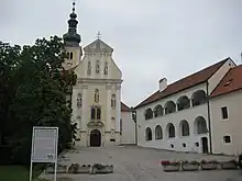
Lepoglava, at the southern terminus of the D508 road
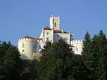
Trakošćan Castle, near the D508 road route
The road, as well as all other state roads in Croatia, is managed and maintained by Hrvatske ceste, state owned company.[4]
Traffic volume
Traffic is regularly counted and reported by Hrvatske ceste, operator of the road.[5]
| D508 traffic volume | ||||
| Road | Counting site | AADT | ASDT | Notes |
| 1102 Pleš (Bednja) | 1,259 | 1,662 | Adjacent to the Ž2099 junction. | |
Road junctions and populated areas
| D508 junctions/populated areas | |
| Type | Slip roads/Notes |
The western terminus of the road. | |
| Trakošćan Ž2056 to Jazbina Cvetlinska. | |
| Pleš | |
| Ž2083 to Vranojelje, Vrbno and Šaša. | |
| Bednja Ž2099 to Gornje Jesenje. | |
| Rinkovec | |
| Muničevec | |
| Lepoglava The eastern terminus of the road. | |
Sources
- "Map of border crossings and customs office areas" (PDF). Customs Administration of the Republic of Croatia (in Croatian). March 6, 2008.
- "Regulation on motorway markings, chainage, interchange/exit/rest area numbers and names". Narodne novine (in Croatian). April 24, 2003. Archived from the original on October 4, 2011. Retrieved August 2, 2010.
- "Decision on categorization of public roads as state roads, county roads and local roads". Narodne novine (in Croatian). February 17, 2010.
- "Public Roads Act". Narodne novine (in Croatian). December 14, 2004.
- "Traffic counting on the roadways of Croatia in 2009 - digest" (PDF). Hrvatske ceste. May 1, 2010. Archived from the original (PDF) on July 21, 2011.
See also
This article is issued from Wikipedia. The text is licensed under Creative Commons - Attribution - Sharealike. Additional terms may apply for the media files.