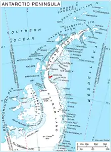
Curran Bluff
Curran Bluff (68°13′S 65°2′W) is a bluff, 2 nautical miles (4 km) long, forming a part of the south coast of Joerg Peninsula, Bowman Coast, south of Reichle Mesa. The bluff rises to 910 metres (3,000 ft) at the west end and is the most prominent feature on the north side of Solberg Inlet. It was photographed from the air by Lincoln Ellsworth, 21 November 1935, and was mapped from these photographs by W.L.G. Joerg. It was named by the Advisory Committee on Antarctic Names for Martin P. Curran, a member of the Pine Island Bay reconnaissance survey in USCGC Burton Island, 1974–75, and Project Manager, RV Hero – Palmer Station Research System, 1976.[1]

References
- "Curran Bluff". Geographic Names Information System. United States Geological Survey, United States Department of the Interior. Retrieved 11 December 2011.
![]() This article incorporates public domain material from "Curran Bluff". Geographic Names Information System. United States Geological Survey.
This article incorporates public domain material from "Curran Bluff". Geographic Names Information System. United States Geological Survey.