Crawleyside
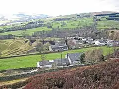
Crawleyside is a village in the civil parish of Stanhope, in County Durham, England. It is situated to the north of Stanhope, in Weardale.[1] In the 2001 census Crawleyside had a population of 170.[2]
| Crawleyside | |
|---|---|
 Crawleyside | |
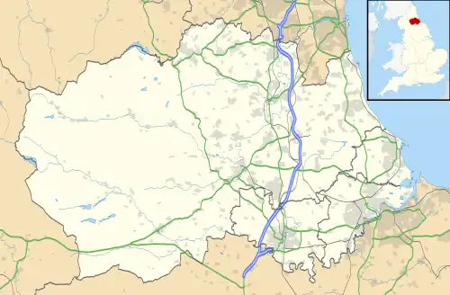 Crawleyside Location within County Durham | |
| Population | 170 (2001 census) |
| OS grid reference | NY993402 |
| Civil parish | |
| Unitary authority | |
| Shire county | |
| Region | |
| Country | England |
| Sovereign state | United Kingdom |
| Post town | Bishop Auckland |
| Postcode district | DL13 |
| Dialling code | 01388 |
| Police | Durham |
| Fire | County Durham and Darlington |
| Ambulance | North East |
| UK Parliament | |
The Crawley Edge Cairns, in a field to the west of the village are a series of forty-two Bronze Age cairns.[3]
References
- Ordnance Survey: Landranger map sheet 91 Appleby-in-Westmorland (Brough & Kirkby Stephen) (Map). Ordnance Survey. 2014. ISBN 9780319231302.
- "Wear Valley Settlement Summary Sheets" (PDF). Durham County Council. Archived from the original (PDF) on 7 October 2007. Retrieved 14 October 2016.
- "PastScape Record: MONUMENT NO. 20163". English Heritage. 2007. Retrieved 22 February 2015.
This article is issued from Wikipedia. The text is licensed under Creative Commons - Attribution - Sharealike. Additional terms may apply for the media files.