Coon Creek Peak
Coon Creek Peak is a mountain in northern Elko County, Nevada, about 4 miles southwest of the community of Jarbidge. It is considered to be the most northeasterly peak of the Copper Mountains.[2] Located a few miles west of the main crest of the Jarbidge Mountains, it is located within the Jarbidge Ranger District of the Humboldt-Toiyabe National Forest. The main road entering Jarbidge from the south, Charleston-Jarbidge Road (National Forest Road 062 and Elko County Route 748[3] [4]), runs along the western slopes of the mountain as it travels between Coon Creek Summit and Bear Creek Summit, providing close vehicular access to the summit of Coon Creek Peak.
| Coon Creek Peak | |
|---|---|
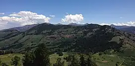 Coon Creek Peak viewed from the west, with the Jarbidge Mountains in the background | |
| Highest point | |
| Elevation | 9,528 ft (2,904 m) NAVD 88[1] |
| Coordinates | 41°48′29″N 115°28′07″W[1] |
| Geography | |
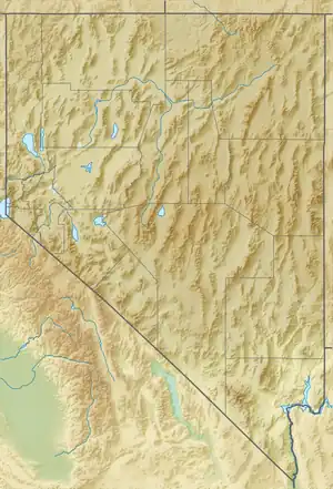 Coon Creek Peak Location of Coon Creek Peak in Nevada, U.S. | |
| Location | Elko County, Nevada, U.S. |
| Topo map | USGS Jarbidge South |
References
- "Coon". NGS Data Sheet. National Geodetic Survey, National Oceanic and Atmospheric Administration, United States Department of Commerce. Retrieved 2014-01-25.
- "Peakbagger.com - Copper Mountains". Retrieved August 28, 2013.
- "Elko County Highway Department Road System" (PDF). Retrieved July 29, 2013.
- Nevada Road & Recreation Atlas (Map). 1:280000. Benchmark Maps. 2007. p. 34-37, 42-45, 51-53. ISBN 0-929591-95-X.
External links
This article is issued from Wikipedia. The text is licensed under Creative Commons - Attribution - Sharealike. Additional terms may apply for the media files.