Condons and Clangibbon
Condons and Clangibbon (Irish: Condúnaigh agus Clann Ghiobúin)[1] is a historical barony in County Cork, Ireland.[2][3]
Condons and Clangibbon
Condúnaigh agus Clann Ghiobúin (Irish) | |
|---|---|
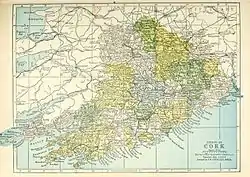 Barony map of County Cork, 1900; Condons and Clangibbon barony is in the northeast, coloured peach. | |
 Condons and Clangibbon | |
| Coordinates: 52°13′26″N 8°12′24″W | |
| Sovereign state | Ireland |
| Province | Munster |
| County | Cork |
| Area | |
| • Total | 315.3 km2 (121.7 sq mi) |
Etymology
.jpg.webp)
Cloghleigh Castle, seat of the Condons.
Condons and Clangibbon takes its name two ruling Norman-Irish families: Condons or Cauntons (Condún),[4] and the FitzGibbons or White Knight.[5]
Geography
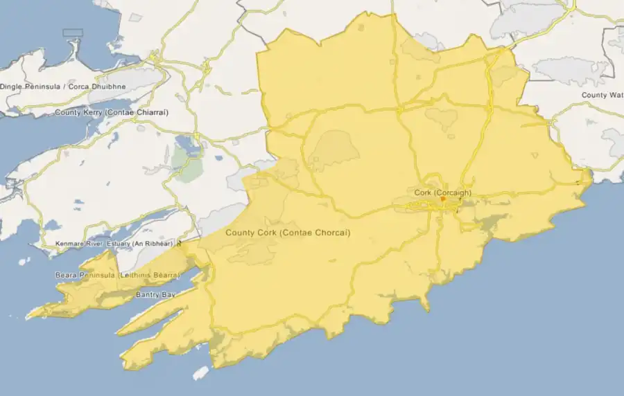
Condons and Clangibbon is located in the northeast of County Cork.
History
The Condon territory was originally held by the O'Kiefs,[6] before being conquered by the Norman Condons. Clangibbon was known as Ive-le-bane (Uibh Le Bán), "the white territory".[7][8] Later much of the barony was owned by the Earls of Kingston.[9]
List of settlements
Settlements within the historical barony of Condons and Clangibbon include:[10][11][12]
References
- An tOrdú Logainmneacha (Contae Chorcaí) 2012 (PDF), Government of Ireland, 2012, p. 91
- "Condúnaigh agus Clann Ghiobúin/Condons and Clangibbon". Logainm.ie.
- "Accounts and Papers of the House of Commons". Great Britain Parliament House of Commons. 1 March 1877 – via Google Books.
- Waters, Eaton W. (1 March 1931). "A holiday spent in Condon's country. With illustrations of Macrony Castle and Curbeigh or Castle Cooks". sources.nli.ie.
- "The Parliamentary Gazetteer of Ireland: Adapted to the New Poor-law, Franchise, Municipal and Ecclesiastical Arrangements, and Compiled with a Special Reference to the Lines of Railroad and Canal Communication, as Existing in 1814-45". A. Fullarton and Company. 1 March 1846 – via Google Books.
- Smith, Charles (1 March 1815). "The Ancient and Present State of the County and City of Cork: Containing a Natural, Civil, Ecclesiastical, Historical and Topographical Description Thereof". J. Connor – via Google Books.
- "The Baronies of Ireland - History". sites.rootsweb.com.
- Smith, Charles (1 March 1701). "The Antient and Present State of the County and City of Cork: In Four Books. ... To which are Added, Curious Notes and Observations, ... Embellished with New and Correct Maps ... Perspective Views of the Chief Towns, and Other Copper-plates. Published with the Approbation of the Physico-Historical Society. By Charles Smith. ..." A. Reilly – via Google Books.
- "Landed Estates | NUI Galway - King". Landed Estates Database. NUI Galway.
- "Places in Kildorrery Registrar's District". www.johngrenham.com.
- Hayman, Samuel (1 March 1881). "Unpublished Geraldine documents, ed. by S. Hayman (J. Graves). From the journ., Roy. hist. and arch. assoc. of Ireland" – via Google Books.
- "The Census of Ireland for the Year 1861". Ireland Census Office. A. Thom. 1 March 1863 – via Google Books.
This article is issued from Wikipedia. The text is licensed under Creative Commons - Attribution - Sharealike. Additional terms may apply for the media files.