Chimney Rock (Canada)
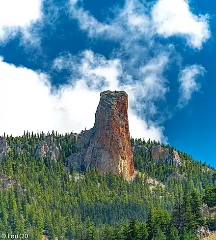
Chimney Rock Statimc, is a limestone formation in Marble Canyon, midway between the towns of Lillooet and Cache Creek in British Columbia, Canada. It is located within Marble Canyon Provincial Park.
Chimney Rock
| Chimney Rock | |
|---|---|
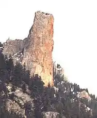 Chimney Rock from the northwest | |
| Highest point | |
| Elevation | 1,725 m (5,659 ft)[1] |
| Prominence | 45 m (148 ft)[1] |
| Listing | Mountains of British Columbia |
| Coordinates | 50°52′42″N 121°43′14″W[1] |
| Geography | |
| Location | British Columbia, Canada |
| Parent range | Marble Range |
| Topo map | NTS 92I13 Pavilion[1] |
| Climbing | |
| First ascent | 1957 Hank Mather; Elfida Pigou[1] |
References
- "Chimney Rock". Bivouac.com. Retrieved 2021-05-27.
This article is issued from Wikipedia. The text is licensed under Creative Commons - Attribution - Sharealike. Additional terms may apply for the media files.