Cape Gray, Greenland
Cape Gray (Danish: Kap Gray) is a headland in North Greenland. Administratively it is part of the Northeast Greenland National Park.
Cape Gray
Kap Gray | |
|---|---|
 Cape Gray | |
| Coordinates: 82°13′N 51°49′W | |
| Location | North Greenland |
| Offshore water bodies | Sherard Osborn Fjord Lincoln Sea |
| Area | |
| • Total | Arctic |
Geography
Cape Gray is located at the southern end of Castle Island, near the mouth of the Sherard Osborn Fjord opposite the eastern shore of Hendrik Island.[1]
Pointing towards the inner fjord, it is one of the two capes of the island, together with the northernmost headland, Cape Cleveland.[2]
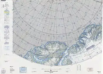 Map of the Nares Strait area. |
See also
References
- "Kap Gray". Mapcarta. Retrieved 29 May 2019.
- Sven Hedin Firn, Army Map Service, United States Army Corps of Engineers, Greenland 1:250,000
This article is issued from Wikipedia. The text is licensed under Creative Commons - Attribution - Sharealike. Additional terms may apply for the media files.