Buffalo–Niagara Falls metropolitan area
The Buffalo–Niagara Falls Metropolitan Statistical Area is a metropolitan area, designated by the United States Census Bureau, encompassing two counties — Erie and Niagara in Western New York. It has a population of almost 1.2 million people. It is the second-largest metropolitan area in the state of New York, centering on the urbanized area of Buffalo. As of April 1, 2020, the metropolitan statistical area (MSA) had a population of 1,166,902. The larger Buffalo Niagara Region is an economic zone consisting of eight counties in Western New York.
Buffalo–Niagara Falls Metropolitan Area | ||
|---|---|---|
| Buffalo–Cheektowaga, NY Metropolitan Statistical Area | ||
Buffalo–Cheektowaga–Olean, NY CSA
| ||
| Coordinates: 42°54′N 78°51′W | ||
| Country | United States | |
| State(s) | New York | |
| Largest city | Buffalo | |
| Other cities | - Niagara Falls - Tonawanda - North Tonawanda - Lackawanna - Lockport - Olean | |
| Area | ||
| • Total | 1,567 sq mi (4,060 km2) | |
| Population (2020)[1] | ||
| • Total | ||
| • Rank | 49th in the U.S. | |
| • Density | 718/sq mi (277/km2) | |
In 2010, the Buffalo – Niagara Falls metropolitan statistical area was ranked the 10th best place in the U.S. for working mothers by ForbesWoman magazine.[2]
Counties
- Erie
- Niagara
- Cattaraugus (part of CSA)
Communities
Cities
- Buffalo
- Lackawanna
- Lockport
- Niagara Falls
- North Tonawanda
- Olean (part of CSA)
- Salamanca (part of CSA)
- Tonawanda
Towns
Villages
Indian Reservations
- Cattaraugus Reservation (partial)
- Tonawanda Reservation (Erie County)
- Tonawanda Reservation (Niagara County)
- Tuscarora Reservation (Niagara County)
Demographics
| Census | Pop. | Note | %± |
|---|---|---|---|
| 1940 | 959,487 | — | |
| 1950 | 1,089,230 | 13.5% | |
| 1960 | 1,306,957 | 20.0% | |
| 1970 | 1,349,211 | 3.2% | |
| 1980 | 1,242,826 | −7.9% | |
| 1990 | 1,189,340 | −4.3% | |
| 2000 | 1,170,111 | −1.6% | |
| 2010 | 1,135,509 | −3.0% | |
| 2020 | 1,166,902 | 2.8% | |
| Historical Population Figures[3] | |||
As of the 2020 Census[4] there were 1,166,902 people residing in the MSA. It was 74.5% White, 13.0% Black or African American, 0.7% American Indian or Alaska Native, 4.2% Asian, <0.1% Pacific Islander, 2.1% Other and 5.5% Two or More Races. 5.8% of the population identified as Hispanic or Latino.
Transportation
Amtrak stations
| Station | Code | City | County | Lines served |
|---|---|---|---|---|
| Buffalo–Depew | BUF | Depew | Erie | Empire Service, Lake Shore Limited, Maple Leaf |
| Buffalo – Exchange Street | BFX | Buffalo | Erie | Empire Service, Maple Leaf |
| Niagara Falls | NFL | Niagara Falls | Niagara | Empire Service, Maple Leaf |
Major airports
| Airport | IATA code | ICAO code | County |
|---|---|---|---|
| Buffalo Niagara International Airport | BUF | KBUF | Erie |
| Niagara Falls International Airport | IAG | KIAG | Niagara |
Combined Statistical Area
The Buffalo–Cheektowaga–Olean combined statistical area (CSA), which includes the Buffalo–Niagara Falls MSA and adds Cattaraugus County, had a population of 1,215,826 inhabitants. It is part of the Great Lakes Megalopolis, which contains an estimated 54 million people.
- Metropolitan Statistical Areas (MSAs)
- Buffalo–Cheektowaga (Erie and Niagara counties)
- Micropolitan Statistical Areas (μSAs)
References
- "2010 Census Data - 2010 Census". 2010.census.gov. Archived from the original on March 24, 2011.
- Casserly, Meghan (July 26, 2010). "Full List: America's Top 50 U.S. Cities For Working Mothers". Forbes.
- "Population Estimates". U.S. Bureau of Census and Real Estate Center at Texas A&M University. 2010. Archived from the original on December 2, 2010. Retrieved 2010-11-10.
- "Buffalo-Cheektowaga, NY Metro Area Demographics and Housing 2020 Decennial Census".
| Principal city | 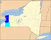 | |
|---|---|---|
| Other major cities | ||
| Counties | ||
| Government and Services |  | |
|---|---|---|
| Transportation | ||
| Research and education | ||
| Medicine and healthcare | ||
| Other topics | ||
| ||
Great Lakes megalopolis as defined by the RPA | ||
|---|---|---|
Includes all metropolitan areas that have a population of 150,000 or greater according to the most recent national census. | ||
| Great Lakes region cities |  | |
| Surrounding cities |
| |
| Cities of states south of region | ||
| Other metro-regions | ||