Broadview Township, North Dakota
Broadview Township[3] is a township in Griggs County, North Dakota, United States.
Broadview Township, North Dakota | |
|---|---|
 Broadview Township, North Dakota Location within the state of North Dakota | |
| Coordinates: 47°17′01″N 98°01′28″W | |
| Country | United States |
| State | North Dakota |
| County | Griggs County |
| Township | Broadview Township |
| Area | |
| • Total | 33.92 sq mi (87.9 km2) |
| Elevation | 1,398 ft (426 m) |
| Population (2020) | |
| • Total | 44 |
| • Density | 1.3/sq mi (0.5/km2) |
| Time zone | UTC-6 (Central (CST)) |
| • Summer (DST) | UTC-5 (CDT) |
| Postal Code(s)[1] | 58086 & 58448 |
| Area code | 701 |
| GNIS feature ID | 1036629 |
| Census Code | 09660 |
| Census Class Code | T1 |
| Website | Griggs County |
| Census | Pop. | Note | %± |
|---|---|---|---|
| 1890 | 92 | — | |
| 1900 | 194 | 110.9% | |
| 1910 | 190 | −2.1% | |
| 1920 | 331 | 74.2% | |
| 1930 | 275 | −16.9% | |
| 1940 | 183 | −33.5% | |
| 1950 | 166 | −9.3% | |
| 1960 | 118 | −28.9% | |
| 1970 | 83 | −29.7% | |
| 1980 | 68 | −18.1% | |
| 1990 | 53 | −22.1% | |
| 2000 | 35 | −34.0% | |
| 2010 | 38 | 8.6% | |
| 2020 | 44 | 15.8% | |
| U.S. Decennial Census[2] | |||
Demographics
Its population during the 2020 census was 44.[2]
Location within Griggs County
Broadview Township is located in Township 144 Range 58 west of the Fifth principal meridian.[4]
| Range 61 | Range 60 | Range 59 | Range 58 | |
|---|---|---|---|---|
| Township 148 | Rosendal | Willow | Pilot Mound | Lenora |
| Township 147 | Bryan | Addie | Tyrol | Romness |
| Township 146 | Kingsley | Clearfield | Cooperstown | Washburn |
| Township 145 | Mabel | Helena | Ball Hill | Sverdrup |
| Township 144 | Dover | Bartley | Greenfield | Broadview |
References
- Statistical Atlas for Broadview Township
- "Decennial Census Official Publications". U.S. Census Bureau.
- U.S. Geological Survey U.S. Board on Geographic Names information for Broadview Township
- Earth Point Tools for Google Earth
Municipalities and communities of Griggs County, North Dakota, United States | ||
|---|---|---|
| Cities | 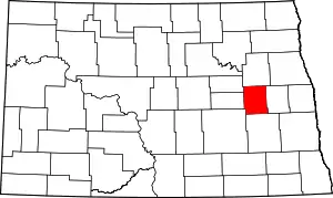 Map of North Dakota highlighting Griggs County | |
| Townships | ||
| CDPs | ||
| Other communities | ||
This article is issued from Wikipedia. The text is licensed under Creative Commons - Attribution - Sharealike. Additional terms may apply for the media files.