Boker Rocks
The Boker Rocks (72°28′S 98°29′W) are a rocky exposure located 5 nautical miles (9 km) northeast of Von der Wall Point on the south coast of Thurston Island. The feature was mapped by the United States Geological Survey from surveys and from U.S. Navy air photos, 1960–66, and named by the Advisory Committee on Antarctic Names for Helmut C. Boker, a meteorologist at Byrd Station, 1964–65.[1]
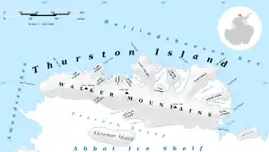
Map of Thurston Island.
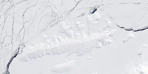
Satellite image of Thurston Island.
Maps
- Thurston Island – Jones Mountains. 1:500000 Antarctica Sketch Map. US Geological Survey, 1967.
- Antarctic Digital Database (ADD). Scale 1:250000 topographic map of Antarctica. Scientific Committee on Antarctic Research (SCAR). Since 1993, regularly upgraded and updated.
References
- "Boker Rocks". Geographic Names Information System. United States Geological Survey, United States Department of the Interior. Retrieved 29 July 2011.
![]() This article incorporates public domain material from "Boker Rocks". Geographic Names Information System. United States Geological Survey.
This article incorporates public domain material from "Boker Rocks". Geographic Names Information System. United States Geological Survey.
This article is issued from Wikipedia. The text is licensed under Creative Commons - Attribution - Sharealike. Additional terms may apply for the media files.