Black Mountain South Top
Black Mountain South Top is a top of Black Mountain in the Black Mountains range that spreads across parts of Powys and Monmouthshire in southeast Wales. It is a top which falls exactly on the Welsh-English border, straddling Powys and Herefordshire. The Offa's Dyke Path passes over the summit.
| Black Mountain South Top | |
|---|---|
 | |
| Highest point | |
| Elevation | 637 m (2,090 ft) |
| Prominence | 15 m (49 ft) |
| Parent peak | Black Mountain |
| Listing | Nuttall |
| Geography | |
| Location | Herefordshire, England / Powys, Wales |
| Parent range | Black Mountains |
| OS grid | SO255350 |
| Topo map | OS Landranger 161 |
| Climbing | |
| Easiest route | The Cat's back |
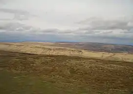
The top is an undistinguished heathery bump on Hatterall Ridge. The summit is marked by a small pile of stones.[1]
References
- Nuttall, John & Anne (1999). The Mountains of England & Wales - Volume 1: Wales (2nd edition). Milnthorpe, Cumbria: Cicerone. ISBN 1-85284-304-7.
This article is issued from Wikipedia. The text is licensed under Creative Commons - Attribution - Sharealike. Additional terms may apply for the media files.