Alt-Hohenschönhausen
Alt-Hohenschönhausen (German: [ˈalt ˌhoːənˌʃøːnˈhaʊ̯zn̩] ⓘ, lit. 'Old Hohenschönhausen') is a locality (Ortsteil) in the borough (Bezirk) of Lichtenberg, Berlin. Known also as Hohenschönhausen it was, until 2001, the main and the eponymous locality of the former Hohenschönhausen borough. In 2008 the population was in excess of 41,000.
Alt-Hohenschönhausen | |
|---|---|
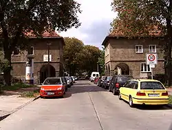 Bruno-Taut-Siedlung | |
 Coat of arms | |
Location of Alt-Hohenschönhausen in Lichtenberg borough and Berlin 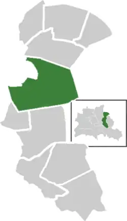 | |
 Alt-Hohenschönhausen 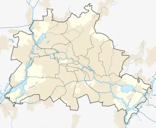 Alt-Hohenschönhausen | |
| Coordinates: 52°35′55″N 13°30′27″E | |
| Country | Germany |
| State | Berlin |
| City | Berlin |
| Borough | Lichtenberg |
| Subdivisions | 8 zones |
| Area | |
| • Total | 9.33 km2 (3.60 sq mi) |
| Elevation | 52 m (171 ft) |
| Population (2020-12-31)[1] | |
| • Total | 50,070 |
| • Density | 5,400/km2 (14,000/sq mi) |
| Time zone | UTC+01:00 (CET) |
| • Summer (DST) | UTC+02:00 (CEST) |
| Postal codes | (nr. 1110) 13053, 13055 |
| Vehicle registration | B |
History
Early history
The earliest evidence of settlement in Alt-Hohenschönhausen are from the Bronze Age, and when the settlement history of the wider Berlin area is taken into consideration, there could have been settlements there since 10,000BC. Alt-Hohenschönhausen was first mentioned in 1230. In the initial centuries of the Common Era the area was mainly inhabited by the Sprevane and Hevelli tribes. By the 13th century the area had been colonised by Germans, particularly from the settlement of Schönhausen, during the eastward migration and settlement of Germans in the medieval period. By the 14th century, the prefix Hoh (high) was added to the name of the village to distinguish itself from the southerly village of Niederschönhausen. The first definitive written record of Hohenschönhausen is from an official certificate to Conradus de Schonehusen, dated 19 August 1284.[2]
Thirty Years' War
From 1626 Hohenschönhausen was affected by the Thirty Years' War. Apart from the Swedish forces who were passing through the area, the troops of Albrecht von Wallenstein also plundered the area and its surroundings, with only the village church remaining undamaged. The result of this was a large-scale desertion of the area by its inhabitants and widespread famine. In the following years, The Plague and other epidemics were reported, including a plague of locusts in 1651. As a result of these factors, the village had lost 58% of its inhabitants by the mid-17th century.
Seven Years' War and Industrialisation
Hohenschönhausen was affected by the Seven Years' War, and was plundered by Austrian and Russian troops after Frederick the Great's defeat at the Battle of Kunersdorf. From 1817 the village and the surrounding estates were under the control of the local state councillor, Christian Friedrich Scharnweber. Under his tenure and those of his successors, Hohenschönhausen began expanding along the road to Berlin. Apart from the settlements, at this point cereals were also widely grown and, after the easing of restrictions in 1810, milled on-site. As the 19th century progressed and Germany began to industrialise, Hohenschönhausen benefitted from investment in infrastructure, such as the opening of an electric tram line in 1899, and a brewery which opened in the early 1890s.
Amalgamation with Berlin
With the Greater Berlin Act of October 1920, Alt-Hohenschönhausen officially became incorporated as part of Greater Berlin within the Weißensee district. Along with the rest of the city, Hohenschönhausen saw food and housing shortages throughout the financial crisis of the mid-1920s.
Nazi Germany
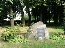
The district was broadly left-wing in the early 1930s; when the Nazi Party took power in 1933, the majority of residents were members of the social democratic parties, the USPD and the SPD. Nevertheless, more than 100 local civil servants were replaced by officials more favourable to the Party on 7 April 1933. After the pogroms of Kristallnacht on 9 November 1938, only some isolated Jews were still allowed to carry out their business, among them was Hohenschönhausen doctor Victor Aronstein, whose waiting room served as a secret meeting place for communists and social democrats until 1939.[3] In 1938 the district's synagogue was completely destroyed by the Nazis; its location is now the site of a memorial to the persecuted Jews of Hohenschönhausen.
Capitulation
Together with Wartenberg, Falkenberg and Marzahn, Hohenschönhausen was one of the first parts of Greater Berlin to be capitulated by the Red Army in the evening of 21 April 1945. Like most of Berlin, the immediate problems facing the area included outbreaks of Typhus and Shigellosis, a lack of gas and electricity, and widespread homelessness and orphancy. By the end of the summer of 1945, schools had re-opened and Hohenschönhausen Castle began functioning as a hospital, which continued until 1989. At around the same time, the Soviet secret police took over a building in an industrial area formerly occupied by the Nazi welfare organisation, the NSV,[4] and converted into use as a detainment and transit camp for prisoners of war, which continued to be used until the beginning of the fall of the German Democratic Republic in 1989.[5]
Hohenschönhausen as part of the GDR
On 18 June 1953 more than 1,000 residents of Alt-Hohenschönhausen took part in the mass uprising which spread throughout the country. Like most of the country, the district saw a reduction in its population up until 1961 when the Berlin Wall was built. In the 1970s the district was expanded with the construction of new high-rise apartment buildings. Thanks to the secretive nature of the prison in Hohenschönhausen, a large part of the district where the facility was located was left blank on official maps.[6]
Post-1989 History
After Die Wende in 1989, East and West Berlin merged to form the federal state of Berlin in 1990. On 1 January 2001 the former borough of Hohenschönhausen, consisting of Alt-Hohenschönhausen as well as the localities Neu-Hohenschönhausen, Malchow, Wartenberg and Falkenberg, was merged with the borough of Lichtenberg into the contemporary borough of Lichtenberg.[7]
Geography
Position
Alt-Hohenschönhausen is situated on the Barnim Plateau in the northeast of Berlin. It borders on the localities of Neu-Hohenschönhausen, Lichtenberg, Fennpfuhl, Marzahn (in Marzahn-Hellersdorf borough) and Weißensee (in Pankow borough).
Subdivision
The district is divided into 8 zones (Viertel):
- Dorfkern
- Gartenstadt
- Märkisches Viertel
- Siedlung Dingelstädter Straße
- Siedlung Malchower Weg
- Villenviertel am Oranksee
- Weiße Taube
- Wilhelmsberg
Culture
Hohenschönhausen Castle is located in Alt-Hohenschönhausen. The Association Hohenschönhausen Castle cares for the restoration and cultural revitalization of this manor house and regularly organizes different events in the castle, such as exhibitions, readings, and concerts.
Transport
Personal transport
The road network in Alt-Hohenschönhausen focuses mainly on some of the historic major roads of the Berlin network, such as Main Street (Hauptstraße) and Konrad Wolf Street (Konrad-Wolf-Straße). According to some estimates, daily traffic on some of the busiest roads in the area can reach 32,000 movements.
Public transport
The district is served by the M4, M5, M6, 16, M17 and 27 lines of the Berlin tram network and by the S-Bahn stations Berlin Gehrenseestraße (S75 line) and Berlin Hohenschönhausen (S75 + DB).
Photo gallery
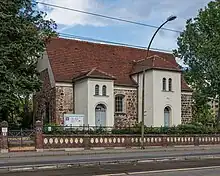 Protestant Tabor Church on the main road
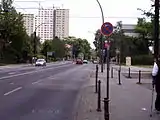 Main road
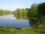 The Obersee lake
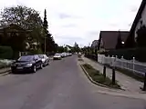 Gottfriedstraße in Gartenstadt
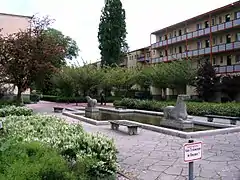 The Siedlung Flusspferdhof
See also
References
- "Einwohnerinnen und Einwohner im Land Berlin am 31. Dezember 2020" (PDF). Amt für Statistik Berlin-Brandenburg. February 2021.
- (in German)Horst Ulrich, Uwe Prell, Ernst Luuk: Hohenschönhausen. In: Berlin Handbuch. Das Lexikon der Bundeshauptstadt. FAB-Verlag, Berlin 1992, ISBN 3-927551-27-9, S. 566.
- (in German)Edition Luisenstadt: Victor Aronstein
- Gedenkstätte Berlin-Hohenschönhausen. "Special Camp 3". Archived from the original on 2 October 2011. Retrieved 9 August 2011.
- Gedenkstätte Berlin-Hohenschönhausen. "Historical Location". Archived from the original on 27 July 2011. Retrieved 9 August 2011.
- History of Hohenschönhausen Prison AwayPlan
- (in German) Historical chronicles of Alt-Hohenschönhausen on the official website of Berlin
Further reading
- Anke Huschner: Geschichte der Berliner Verwaltungsbezirke. Hohenschönhausen. Band 15. Stapp Verlag, Berlin 1995, ISBN 3-87776-070-8.
- Bärbel Ruben: Hohenschönhausen wie es früher war. 1. Auflage. Wartberg Verlag GmbH, 1999, ISBN 3-86134-532-3.
- Walter Püschel: Spaziergänge in Hohenschönhausen. Haude & Spenersche Verlagsbuchhandlung GmbH, Berlin 1995, ISBN 3-7759-0398-4.
- Peter Erler, Hubertus Knabe: Der verbotene Stadtteil. Stasi-Sperrbezirk Berlin-Hohenschönhausen. Jaron Verlag, 2004, ISBN 3-89773-506-7.
External links
![]() Media related to Alt-Hohenschönhausen at Wikimedia Commons
Media related to Alt-Hohenschönhausen at Wikimedia Commons
- (in German) Alt-Hohenschönhausen page on www.berlin.de