Benkovski Nunatak
Benkovski Nunatak (\ben-'kov-ski 'nu-na-tak\) is a rocky peak of elevation 450 m projecting from the ice cap of Greenwich Island in the northeast extremity of Breznik Heights.
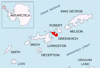
Location of Greenwich Island in the South Shetland Islands.

Benkovski Nunatak from Bransfield Strait, with Parchevich Ridge on the left and Bogdan Ridge on the right.
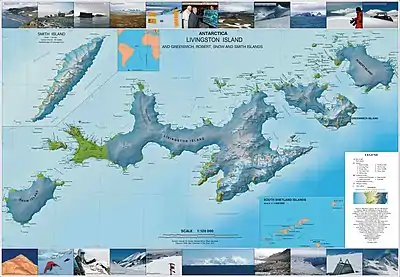
Topographic map of Livingston Island, Greenwich, Robert, Snow and Smith Islands.
The peak was named after Georgi Benkovski (1843–76), a leader of the 1876 April Uprising for Bulgarian independence.
Location
Benkovski Nunatak is located at 62°30′13″S 59°34′56″W, which is 920 m west-southwest of Bogdan Ridge, and 690 m north of Parchevich Ridge. Overlooking Gruev Cove to the east. Bulgarian topographic survey Tangra 2004/05.
Maps
- L.L. Ivanov. Antarctica: Livingston Island and Greenwich, Robert, Snow and Smith Islands. Scale 1:120000 topographic map. Troyan: Manfred Wörner Foundation, 2009. ISBN 978-954-92032-6-4
References
- Benkovski Nunatak. SCAR Composite Gazetteer of Antarctica
- Bulgarian Antarctic Gazetteer. Antarctic Place-names Commission. (details in Bulgarian, basic data in English)
External links
- Benkovski Nunatak. Copernix satellite image
This article includes information from the Antarctic Place-names Commission of Bulgaria which is used with permission.
This article is issued from Wikipedia. The text is licensed under Creative Commons - Attribution - Sharealike. Additional terms may apply for the media files.