List of beaches in the U.S. Virgin Islands
The following is a list of beaches in the United States Virgin Islands by district/island of the United States Virgin Islands, a territory of the United States. Beaches are on the Caribbean Sea to the south or Atlantic Ocean to the north.[1]
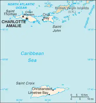
Map of the U.S. Virgin Islands
Saint Croix

Turtle Beach, Buck Island
Saint John
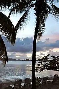
Caneel Beach
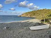
Beach at Kiddel Bay
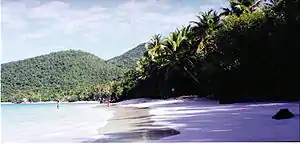
Gibney Beach, aka Oppenheimer Beach
.jpg.webp)
Trunk Bay, St. John
Saint Thomas
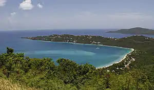
Magens Bay, St. Thomas

Coki Beach
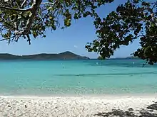
Linquist Beach
There are forty major beaches in Saint Thomas.[74]
| Name | Coordinates |
|---|---|
| Bluebeard Beach | 18°19′29″N 64°50′18″W[75] |
| Bolongo Bay | 18°18′42″N 64°53′45″W[76][74] |
| Brewers Bay Beach | 18°20′37″N 64°58′38″W[77][74] |
| Coki Beach (Coki Point) | 18°20′59″N 64°51′56″W[78][74] |
| Cowpet Bay | 18°18′58″N 64°50′31″W[74][79] |
| Dorothea Bay | 18°22′13″N 64°57′44″W[80][74] |
| Great Bay | 18°19′17″N 64°50′16″W[74][81] |
| Hull Bay Beach | 18°22′09″N 64°57′25″W[82][74] |
| Limetree Beach | 18°19′01″N 64°54′48″W[83][74] |
| Lindbergh Beach | 18°20′07″N 64°57′52″W[84][74] |
| Lindquist Beach (Smith Bay, Cabes Point) | 18°20′23″N 64°51′01″W[74][85] |
| Magens Bay (Little Magens) | 18°22′15″N 64°56′09″W[86][74] |
| Mandahl Bay Beach | 18°21′39″N 64°53′50″W[74][87] |
| Morningstar Beach | 18°19′13″N 64°55′11″W[88][74] |
| Sapphire Beach | 18°20′06″N 64°57′01″W[89][74] |
| Secret Harbor Beach | 18°19′05″N 64°51′11″W[90][74] |
| Sugar Bay (Wyndham) | 18°21′54″N 65°00′03″W[74][91] |
| Vessup Bay | 18°19′31″N 64°51′01″W[92][74] |
| Water Bay (aka Pineapple or Renaissance Bay) | 18°20′51″N 64°51′50″W[93][74] |
Water Island
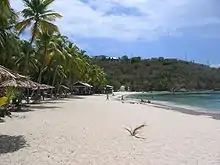
Honeymoon Beach, Water Island
The following beaches are in Water Island, a sub-district of the Saint Thomas District.[94]
| Name | Coordinates |
|---|---|
| Honeymoon Beach | 18°18′51″N 64°57′39″W[95] |
| Limestone Beach | |
| Revenge Beach | 18°18′34″N 64°57′12″W[96] |
| Sprat Bay | |
| Waterlemon Cay Beach | 18°22′01″N 64°43′22″W[97] |
See also
References
- "U.S. Virgin Islands beaches". GeoNames. Retrieved September 20, 2021.
- "Altona Lagoon Beach". GeoNames. Retrieved September 20, 2021.
- "Buccaneer Beach". GeoNames. Retrieved September 20, 2021.
- "Cane Bay Beach". GeoNames. Retrieved September 20, 2021.
- "St. Croix Beach Guide". VI now. Retrieved 2018-07-31.
- "Carlton Beach". GeoNames. Retrieved September 20, 2021.
- "Cathys Fancy Beach". GeoNames. Retrieved September 20, 2021.
- "Cay Beach". GeoNames. Retrieved September 20, 2021.
- "Chenay Bay". GeoNames. Retrieved September 20, 2021.
- "Coakley Bay". GeoNames. Retrieved September 20, 2021.
- "Columbus Landing". GeoNames. Retrieved September 20, 2021.
- "Cormorant Beach Club". GeoNames. Retrieved September 20, 2021.
- "Cottongarden Bay Beach". GeoNames. Retrieved September 20, 2021.
- "Cramere Park Beach". GeoNames. Retrieved September 20, 2021.
- "Davis Beach". GeoNames. Retrieved September 20, 2021.
- "Divi Carina Bay". GeoNames. Retrieved September 20, 2021.
- "Sand Castle on the Beach". GeoNames. Retrieved September 20, 2021.
- "Frederiksted Beach". GeoNames. Retrieved September 20, 2021.
- "Grapetree Beach". GeoNames. Retrieved September 20, 2021.
- "Grassy Point Beach". GeoNames. Retrieved September 20, 2021.
- "Issacs Bay Beach". GeoNames. Retrieved September 20, 2021.
- "Judiths Fancy Beach". GeoNames. Retrieved September 20, 2021.
- "LaGrange Beach". GeoNames. Retrieved September 20, 2021.
- "Monks Bath Beach". GeoNames. Retrieved September 20, 2021.
- "North Star Beach". GeoNames. Retrieved September 20, 2021.
- "Pelican Cove Beach". GeoNames. Retrieved September 20, 2021.
- "Prune Beach". GeoNames. Retrieved September 20, 2021.
- "Rainbow Beach". GeoNames. Retrieved September 20, 2021.
- "Reef Beach". GeoNames. Retrieved September 20, 2021.
- "Saint Croix Country Club Beach". GeoNames. Retrieved September 20, 2021.
- "Salt River Beach". GeoNames. Retrieved September 20, 2021.
- "Shoys Beach". GeoNames. Retrieved September 20, 2021.
- "Sonofa Beach". GeoNames. Retrieved September 20, 2021.
- "Sprat Hall Beach". GeoNames. Retrieved September 20, 2021.
- "Sugar Beach". GeoNames. Retrieved September 20, 2021.
- "Tamarind Reef Beach". GeoNames. Retrieved September 20, 2021.
- "West Beach". GeoNames. Retrieved September 20, 2021.
- "St. John Beach Guide". VI now. Retrieved 2018-07-31.
- "St. John Beaches Map". St. John Tour. Retrieved September 20, 2021.
- "Annaberg Beach". GeoNames. Retrieved September 20, 2021.
- "Blue Cobblestone Beach". GeoNames. Retrieved September 20, 2021.
- "Boatman Point Beach". GeoNames. Retrieved September 20, 2021.
- "Brown Bay Beach". GeoNames. Retrieved September 20, 2021.
- "Caneel Bay Beach". GeoNames. Retrieved September 20, 2021.
- "Cinnamon Bay Beach". GeoNames. Retrieved September 20, 2021.
- "Cocoloba Beach". GeoNames. Retrieved September 20, 2021.
- "Cruz Bay Beach". GeoNames. Retrieved September 20, 2021.
- "Denis Bay". GeoNames. Retrieved September 20, 2021.
- "Ditleff Beach". GeoNames. Retrieved September 20, 2021.
- "Fish Bay". GeoNames. Retrieved September 20, 2021.
- "Francis Bay Beach". GeoNames. Retrieved September 20, 2021.
- "Gibney Beach". GeoNames.
- "Hansen Bay Beach". GeoNames. Retrieved September 20, 2021.
- "Hart Bay Beach". GeoNames. Retrieved September 20, 2021.
- "Haulover Beach". GeoNames. Retrieved September 20, 2021.
- "Hawknest Beach". GeoNames. Retrieved September 20, 2021.
- "Honeymoon Bay". GeoNames. Retrieved September 20, 2021.
- "Johns Folly Beach". GeoNames. Retrieved September 20, 2021.
- "Jumbie Bay". GeoNames. Retrieved September 20, 2021.
- "Lameshur Bay". GeoNames. Retrieved September 20, 2021.
- "Leinster Bay". GeoNames. Retrieved September 20, 2021.
- "Little Cinnamon Bay Beach". GeoNames. Retrieved September 20, 2021.
- "Little Maho Beach". GeoNames. Retrieved September 20, 2021.
- "Little Reef Bay Beach". GeoNames. Retrieved September 20, 2021.
- "Long Bay Beach". GeoNames. Retrieved September 20, 2021.
- "Maho Bay Beach". GeoNames. Retrieved September 20, 2021.
- "Peter Bay Beach". GeoNames. Retrieved September 20, 2021.
- "Reef Bay Beach". GeoNames. Retrieved September 20, 2021.
- "Salt Pond Beach". GeoNames. Retrieved September 20, 2021.
- "Salomon Beach". GeoNames. Retrieved September 20, 2021.
- "St. Mary's Creek Beach". GeoNames. Retrieved September 20, 2021.
- "Trunk Beach". GeoNames. Retrieved September 20, 2021.
- "Waterlemon Cay Beach". GeoNames. Retrieved September 20, 2021.
- "St. Thomas Beach Guide". Virgin Islands Now. Retrieved 2018-07-31.
- "Bluebeard Beach". GeoNames. Retrieved September 20, 2021.
- "Bolongo Bay". GeoNames. Retrieved September 20, 2021.
- "Brewers Bay Beach". GeoNames. Retrieved September 20, 2021.
- "Coki Beach". GeoNames. Retrieved September 20, 2021.
- "Cowpet Bay". GeoNames. Retrieved September 20, 2021.
- "Dorothea Bay". GeoNames. Retrieved September 20, 2021.
- "Great Bay". GeoNames. Retrieved September 20, 2021.
- "Hull Bay Beach". GeoNames. Retrieved September 20, 2021.
- "Limetree Beach". GeoNames. Retrieved September 20, 2021.
- "Lindbergh Beach". GeoNames. Retrieved September 20, 2021.
- "Cabes Point". GeoNames. Retrieved September 20, 2021.
- "Bagens Bay". GeoNames. Retrieved September 20, 2021.
- "Mandahl Bay Beach". GeoNames. Retrieved September 20, 2021.
- "Morningstar Beach". GeoNames. Retrieved September 20, 2021.
- "Sapphire Beach". GeoNames. Retrieved September 20, 2021.
- "Secret Harbor Beach". GeoName. Retrieved September 20, 2021.
- "Wyndham Sugar Bay". GeoNames. Retrieved September 20, 2021.
- "Vessup Bay". GeoNames.
{{cite web}}: Missing or empty|url=(help) - "Water Bay". GeoNames. Retrieved September 20, 2021.
- "Water Island Beach Guide". VI now. Retrieved 2018-07-31.
- "Honeymoon Beach". GeoNames. Retrieved September 20, 2021.
- "Revenge Beach". GeoNames. Retrieved September 20, 2021.
- "Waterlemon Cay Beach". GeoNames. Retrieved September 20, 2021.
External links
Wikimedia Commons has media related to Beaches of the United States Virgin Islands.
This article is issued from Wikipedia. The text is licensed under Creative Commons - Attribution - Sharealike. Additional terms may apply for the media files.