Bastiments
Bastiments is a mountain peak at the easternmost side of the Pyrenees mountain range. It is located on the Spanish-French border, within the confluence of the Spanish municipalities of Setcases and Queralbs and the French commune of Fontpédrouse. it has an altitude of 2,881 metres (9,452 ft) above sea level.[1]
| Bastiments | |
|---|---|
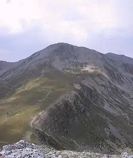 The summit of Bastiments as seen from Gra de Fajol | |
| Highest point | |
| Elevation | 2,881 m (9,452 ft) |
| Prominence | 276 m (906 ft) |
| Isolation | 10.65 km (6.62 mi) to Puigmal |
| Coordinates | 42°25′38.65″N 02°14′3.06″E |
| Geography | |
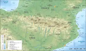 Bastiments Location in the Pyrenees | |
| Location | Pyrénées-Orientales, France Catalonia, Spain |
| Parent range | Pyrenees |
See also
References
- "Mapa Topogràfic de Catalunya". Institut Cartogràfic de Catalunya. Retrieved May 22, 2010..
Bastiments
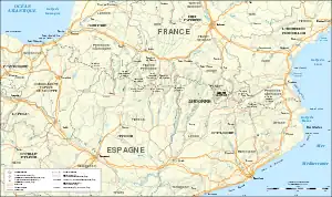
Main roads and railway metwork. The summit of the Peak of Bastiments (2,881m) is a landmark of the French-Spanish border
This article is issued from Wikipedia. The text is licensed under Creative Commons - Attribution - Sharealike. Additional terms may apply for the media files.