Bamfurlong, Greater Manchester
Bamfurlong is a small village in the Metropolitan Borough of Wigan, Greater Manchester, England.
| Bamfurlong | |
|---|---|
%252C_Bamfurlong_(geograph_2818380).jpg.webp) Lily Lane (A58), Bamfurlong | |
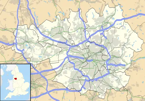 Bamfurlong Location within Greater Manchester | |
| OS grid reference | SD596014 |
| Metropolitan borough | |
| Metropolitan county | |
| Region | |
| Country | England |
| Sovereign state | United Kingdom |
| Post town | WIGAN |
| Postcode district | WN2 |
| Dialling code | 01942 |
| Police | Greater Manchester |
| Fire | Greater Manchester |
| Ambulance | North West |
| UK Parliament | |
Location
It lies approximately 2.6 miles (4.2 km) south of Wigan town centre and 1.7 miles (2.7 km) to the north east of Ashton-in-Makerfield town centre. Bamfurlong has a population of around 2,500 people.

Remains of the station in 1962
Bamfurlong is within the ward of Abram.[1] For transport it is relatively close to the M6 motorway. Bamfurlong railway station served the village from 1832 until closure in 1950.[2]
The proposed High Speed 2 line coming from the south would connect to the West Coast Main Line at the site of the closed station, allowing high-speed services to continue north on slower tracks. No station will be built in the village.[3]
Neighbouring towns, villages and places. | ||||||||||||||||
|---|---|---|---|---|---|---|---|---|---|---|---|---|---|---|---|---|
| ||||||||||||||||
References
Wikimedia Commons has media related to Bamfurlong, Greater Manchester.
- "Abram Ward Information". Archived from the original on 6 January 2009. Retrieved 4 August 2010.
- "Disused Stations: Bamfurlong Station". Disused Stations. 4 June 2017. Archived from the original on 9 August 2020. Retrieved 8 June 2022.
- High Speed Two Property Consultation (pdf) (Report). gov.uk. November 2016. Archived (PDF) from the original on 8 June 2022. Retrieved 8 June 2022.
This article is issued from Wikipedia. The text is licensed under Creative Commons - Attribution - Sharealike. Additional terms may apply for the media files.