Ardnadam
Ardnadam (Scottish Gaelic: Àird nan Damh) is a village on the Holy Loch on the Cowal peninsula, Argyll and Bute, Scotland. It is located northwest of Hunters Quay and east of Sandbank, and sits across the loch from Kilmun.[1][2]
Ardnadam
| |
|---|---|
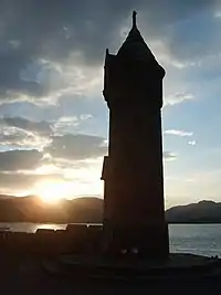
 Sunset from Lazaretto Point | |
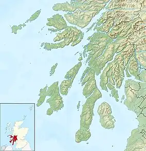
 Ardnadam Location within Argyll and Bute | |
| OS grid reference | NS17008000 |
| Council area | |
| Lieutenancy area | |
| Country | Scotland |
| Sovereign state | United Kingdom |
| Post town | DUNOON, ARGYLL |
| Postcode district | PA23 |
| Dialling code | 01369 |
| UK Parliament | |
| Scottish Parliament | |
History
"Ardnadam village is of very recent date," wrote John Colegate in 1868.[3] "Only a few years ago, an excellent pier and hotel were built. Since then, many feus have been taken, and neat cottages erected thereon." The first proprietor of The Ardnadam, the village's early hotel, was Mr Jamieson. He was also the pier master.[3]
Lazaretto Point War Memorial
The memorial is situated on the Holy Loch shore next to the A815 road. It commemorates the fallen of the First and Second World Wars.[4]
Trails
Ardnadam Heritage Trail
Ardnadam Heritage Trail is 2.75 miles (4.43 km) long and climbs to Dunan Hill (Camel's Hump), which has views across Loch Loskin, Dunoon, Holy Loch and the Firth of Clyde.[5]
Other walking trails go beside Loch Loskin, and to the site of an ancient cromlech on the nearby Ardnadam Farm.[3][6]
Lazaretto Point Quarantine Station
Lazaretto Point in Ardnadam was the site of a quarantine station, built in 1807, to treat disease brought into the Clyde ports with imported cotton shipments. The station was demolished in 1840.[7][8]
Gallery
 Lazaretto Memorial
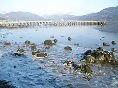
 Ardnadam Pier and the Holy Loch
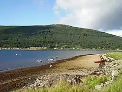
 Ardnadam Bay
References
- Ordnance Survey: Landranger map sheet 63 Firth of Clyde (Greenock & Rothesay) (Map). Ordnance Survey. 2014. ISBN 9780319229699.
- "Ordnance Survey: 1:50,000 Scale Gazetteer" (csv (download)). www.ordnancesurvey.co.uk. Ordnance Survey. 1 January 2016. Retrieved 30 January 2016.
- Colegate's Guide to Dunoon, Kirn, and Hunter's Quay (Second edition) - John Colegate (1868), page 31
- "Sandbank and Ardnadam". Imperial War Museums.
- "Dunan - the Camel's Hump, Ardnadam". Walkhighlands. Retrieved 17 January 2017.
- Ordnance Gazetteer of Scotland: A Graphic and Accurate Description of Every Place in Scotland, Francis Hindes Groome (1901), p. 445
- "Secret Scotland - Holy Loch". www.secretscotland.org.uk.
- "Historic Kilmun - Lazaretto". www.historickilmun.org.