Anaconda Peak
Anaconda Peak (8,279 feet (2,523 m)) is located in the Livingston Range, Glacier National Park in the U.S. state of Montana,[3] to the southeast of the eastern reaches of Logging Lake.
| Anaconda Peak | |
|---|---|
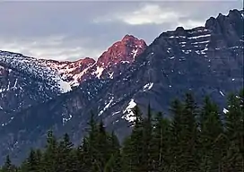 West aspect, centered | |
| Highest point | |
| Elevation | 8,279 ft (2,523 m)[1] |
| Prominence | 919 ft (280 m)[1] |
| Coordinates | 48°46′06″N 113°58′24″W[2] |
| Geography | |
 Anaconda Peak Location in Montana  Anaconda Peak Location in the United States | |
| Location | Flathead County, Montana, U.S. |
| Parent range | Livingston Range |
| Topo map | USGS Mount Geduhn, MT |
Climate
Based on the Köppen climate classification, the peak is in an alpine subarctic climate zone with long, cold, snowy winters, and cool to warm summers.[4] Temperatures can drop below −10 °F with wind chill factors below −30 °F.
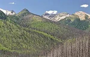
East aspect of Anaconda Peak centered on skyline, from Going-to-the-Sun Road
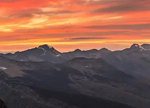
Anaconda Peak is a bump centered along skyline. Longfellow Peak to left. View from Logan Pass.
References
- "Anaconda Peak, Montana". Peakbagger.com. Retrieved December 27, 2018.
- "Anaconda Peak". Geographic Names Information System. United States Geological Survey, United States Department of the Interior. Retrieved December 27, 2018.
- Mount Geduhn, MT (Map). TopoQwest (United States Geological Survey Maps). Retrieved December 27, 2018.
- Peel, M. C.; Finlayson, B. L.; McMahon, T. A. (2007). "Updated world map of the Köppen−Geiger climate classification". Hydrol. Earth Syst. Sci. 11: 1633–1644. ISSN 1027-5606.
This article is issued from Wikipedia. The text is licensed under Creative Commons - Attribution - Sharealike. Additional terms may apply for the media files.