Ames Range
The Ames Range is an Antarctic range of snow-covered, flat-topped, steep-sided mountains, extending in a N-S direction for 32 km (20 mi) and forming a right angle with the eastern end of the Flood Range in Marie Byrd Land.
| Ames Range | |
|---|---|
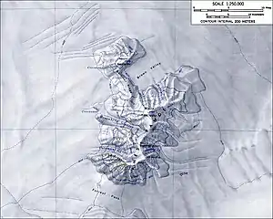 Map of the Ames Range | |
| Highest point | |
| Peak | Mount Andrus |
| Elevation | 2,978 m (9,770 ft) |
| Coordinates | 75°42′S 132°20′W |
| Geography | |
| Continent | Antarctica |
| Region | Marie Byrd Land |
| Geology | |
| Formed by | Shield volcanoes |
| Volcanic field | Marie Byrd Land Volcanic Province |
They were discovered by the United States Antarctic Service Expedition (1939–41) and named by Richard E. Byrd for his father-in-law, Joseph Ames.
The Ames Range consists of three coalescing shield volcanoes: Mount Andrus, Mount Kosciusko and Mount Kauffman, and Mount Boennighausen.[1]
Other Features
There are several glaciers draining from the Ames Range:
Other features include:
- Brown Valley
- Gardiner Ridge, connecting Mt. Kosciusko to Mt. Kauffman
- Lind Ridge
- Forrest Pass, which separates the Ames Range from the Flood Range
This article is issued from Wikipedia. The text is licensed under Creative Commons - Attribution - Sharealike. Additional terms may apply for the media files.