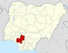
Akoko Edo
Akoko Edo is a Local Government Area in Edo State, Nigeria. Its headquarters is in the town of Igarra.[1][2] It has an area of 1,371 km2 and a population of 262,110 at the 2006 census.[3] The earliest settlers of Akoko Edo were the Benins who would have been there the same period the Etsako people moved from Benin during the reign of Oba Ozolua (1483-1504). Other migrating people, due to the fortunes of time, came into the area. Of the Igbirra and Idah from the North and East, the war which Oba Esigie fought in 1515-1516 with the Attah of Idah would have brought a lot of migration into the area.[4]
Akoko Edo
Akoko Ẹdo | |
|---|---|
| Country | Nigeria |
| State | Edo State |
| Headquarters | Igarra |
| Time zone | UTC+1 (WAT) |
The postal code of the area is 312.
As of 2016, its population density is 249.9/km2 [2016][5]
The first local government chairman is Chief Joshua.B.Mayaki.
Geography
The Ancient Akoko-Edo area is situated in the northern part of Edo state in the south of the Niger-Benue Confluence. Its dominant geographical and environmental features are chains of ancient ridges of rugged rocky hills and a cave, stretching across the length and breadth of what is now known as the Akoko-Edo LGA of the present Northern Edo State, located between "latitudes 45 N 35 N and longitudes 55 E, 45 E".[6] Akoko-Edo, with a population of about 124, 000 by the 1991 census, and 261, 567 by the 2006 National Population Census, occupies a land area of about 1, 371 square kilometers or 6.5% of Edoland and constitutes about 5.70% of Edo state population. The area is described as the ancestral homeland of all the sub-ethnic peoples who have been the speakers of the ancient language which is classified as Edoid.[6] Akoko-Edo is bounded in the North by the present Kwara state and parts of the present Kogi state, in the north-west by the present Ondo state, in the south-east by both Etsako west (Auchiclans) and Etsako north (Okpella), and in the south-west by Owan.[7]
Towns
The towns include Egbigere 1, Egbigere 2, Atte, Igarra, Enwan, Aiyegunle, Ugboshi-Afe, Ugboshi-Ele, Ekpesa, Ibillo, Ikiran-Ile, Ikiran oke, Ekor, Somorika, Lampese, Imoga, Ojah, Uneme-Akiosu, Ososo, Akuku, Ojirami-Dam, Imoga, Eshawa, Ojirami-Peteshi Ojirami-Afe, Dagbala, Makeke, Ekpe, Ekpedo, Bekuma, Okpe, Ogbe, Onumu, Akpama, Anyonron, Ogugu, Ikakumo, Ijaja, Oloma, Okunese, Uneme-nekua, uneme erhurun and Ikpeshi.[8][9]
Languages
The people of Akoko Edo speak Eight (8) distinct languages but overlapping occurs. The Ojiramis (Group II) for instance, understand their neighbours Akuku (Group III) and Enwan (Group I), but not the people in the other village. Yoruba is understood by mainly the older generation. Pidgin English is the most widely spoken language in Akoko Edo.
References
- Edoaffairs (2019-08-16). "Edo State Local Government Areas and Headquarter Edoaffairs". Edoaffairs. Retrieved 2023-01-24.
- "Flood disaster claims lives and destroys property in Akoko-Edo". Independent Television/Radio. 2014-07-16. Retrieved 2023-01-23.
- places. "Towns & Villages in Akoko – Edo « Edo State « Nigeria". Towns & Villages. Retrieved 2023-01-24.
- "Akoko Edo people of Edo State, Nigeria". www.edoworld.net. Retrieved 2023-04-25.
- "Nigeria: Administrative Division (States and Local Government Areas) - Population Statistics, Charts and Map". citypopulation.de. Retrieved 2020-04-20.
- Samson, Orifah. "The Linguistic Situation and Geography of Akoko-Edo Local Government Area, Edo State, Nigeria".
{{cite journal}}: Cite journal requires|journal=(help) - "Boundary dispute: Two communities in Edo and Ondo states on edge". The Guardian Nigeria News - Nigeria and World News. 2018-03-25. Retrieved 2021-07-13.
- "Post Offices- with map of LGA". NIPOST. Archived from the original on 7 October 2009. Retrieved 2009-10-20.
- Mary (2014-03-03). "List of Towns and Villages in Akoko - Edo LGA". Nigeria Zip Codes. Retrieved 2023-05-02.
