AEGIS (astronomy)
AEGIS, or the All-Wavelength Extended Groth Strip International Survey, is a multi-wavelength astronomical survey of a patch of the sky with low extinction and zodiacal scattering. The purpose of the survey is to study the physical processes and evolution of galaxies at redshift z ~ 1. As of February 2011 more than 80 research papers have been published based on data from the survey.[2]
| Alternative names | All-Wavelength Extended Groth Strip International Survey |
|---|---|

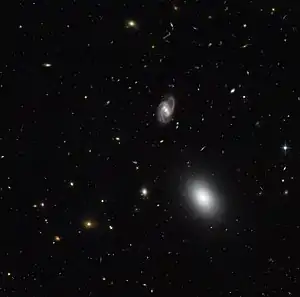
Extended Groth Strip taken with Hubble’s Advanced Camera for Surveys.[1]
Observatories
AEGIS makes use of multiple terrestrial and space based observatories to conduct the survey. These observatories make overlapping scans of the survey area.[3] The primary telescopes are:[4]
See also
- Extended Groth Strip – a visible image taken by Hubble of the region.
References
- "A Snapshot of Galactic Evolution". ESA/Hubble. 10 October 2011. Retrieved 11 October 2011.
- AEGIS Papers retrieved February 10, 2011
- EGS Coverage
- "Official Project Site". Archived from the original on 2007-03-15. Retrieved 2011-02-11.
- https://web.archive.org/web/20110811231439/http://astro.imperial.ac.uk/research/aegis/
This article is issued from Wikipedia. The text is licensed under Creative Commons - Attribution - Sharealike. Additional terms may apply for the media files.